![](/images/other/stat-length.png)
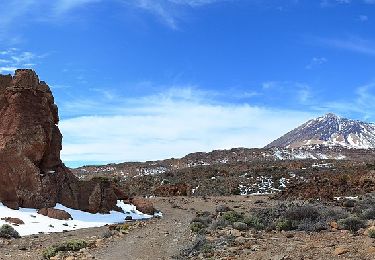
![Trail On foot Los Realejos - S-22 Lomo Hurtado - Photo](https://media.geolcdn.com/t/1900/400/36653422-136c-4699-a446-bdcd02c297af.jpeg&format=pjpeg&maxdim=2)
S-22 Lomo Hurtado
SityTrail - itinéraires balisés pédestres
Tous les sentiers balisés d’Europe GUIDE+
![Length](/images/other/stat-length.png)
Length
4.9 km
![Max alt](https://static1.geolcdn.com/siteimages/upload/files/1508320355ic_sort_altitude_max_24dp.png)
Max alt
2481 m
![Uphill gradient](https://static1.geolcdn.com/siteimages/upload/files/1508320355ic_sort_den_pos_24dp.png)
Uphill gradient
433 m
![Km-Effort](/images/other/stat-length.png)
Km-Effort
9.3 km
![Min alt](https://static1.geolcdn.com/siteimages/upload/files/1508320355ic_sort_altitude_min_24dp.png)
Min alt
2054 m
![Downhill gradient](https://static1.geolcdn.com/siteimages/upload/files/1508320355ic_sort_den_neg_24dp.png)
Downhill gradient
28 m
![Boucle](https://static1.geolcdn.com/siteimages/upload/files/16400158638029165_repeat_loop_refresh_sync_direction_icon.png)
Boucle
No
Signpost
Creation date :
2022-02-14 14:20:23.049
Updated on :
2022-02-14 14:20:23.049
![On foot](https://static1.geolcdn.com/sitytour/trail-icons/100.png)
2h06
Difficulty : Easy
![Scan this QR Code to open this trail in the SityTrail application](https://capi.geolives.com/qq0zvz2zws4bq2lad0pu/sitytour/trails/3108254/qr.png?size=200)
FREE GPS app for hiking
About
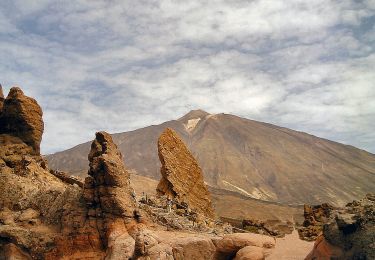
Trail On foot of 4.9 km to be discovered at Canary Islands, Santa Cruz de Tenerife, Los Realejos. This trail is proposed by SityTrail - itinéraires balisés pédestres.
Description
Trail created by Parque Nacional del Teide.
Positioning
Country:
Spain
Region :
Canary Islands
Department/Province :
Santa Cruz de Tenerife
Municipality :
Los Realejos
Location:
Unknown
Start:(Dec)
Start:(UTM)
344276 ; 3132601 (28R) N.
Comments
Trails nearby
![Trail On foot La Orotava - S-30 Los Valles - Photo](https://media.geolcdn.com/t/375/260/281af76a-1e1a-4300-89ab-f6674754c3ad.jpeg&format=jpg&maxdim=2)
![On foot On foot](https://static1.geolcdn.com/sitytour/trail-icons/100.png)
S-30 Los Valles
On foot
Easy
La Orotava,
Canary Islands,
Santa Cruz de Tenerife,
Spain
![](/images/other/stat-length.png)
4.9 km | 5.8 km-effort
1h 18min
![](https://static1.geolcdn.com/siteimages/upload/files/16400158638029165_repeat_loop_refresh_sync_direction_icon.png)
No
![Trail On foot La Orotava - S-7 Montaña Blanca-La Rambleta - Photo](https://media.geolcdn.com/t/375/260/2f181b8b-c0a2-49c0-9f60-b40365cab2be.jpeg&format=jpg&maxdim=2)
![On foot On foot](https://static1.geolcdn.com/sitytour/trail-icons/100.png)
S-7 Montaña Blanca-La Rambleta
On foot
Easy
La Orotava,
Canary Islands,
Santa Cruz de Tenerife,
Spain
![](/images/other/stat-length.png)
8.2 km | 12.2 km-effort
2h 45min
![](https://static1.geolcdn.com/siteimages/upload/files/16400158638029165_repeat_loop_refresh_sync_direction_icon.png)
No
![Trail On foot Los Realejos - S-6 Montaña de Los Tomillos - Photo](https://media.geolcdn.com/t/375/260/f9cd0d8d-8278-4ad9-9ac9-301cd0450900.jpeg&format=jpg&maxdim=2)
![On foot On foot](https://static1.geolcdn.com/sitytour/trail-icons/100.png)
S-6 Montaña de Los Tomillos
On foot
Easy
Los Realejos,
Canary Islands,
Santa Cruz de Tenerife,
Spain
![](/images/other/stat-length.png)
5.1 km | 9.7 km-effort
2h 12min
![](https://static1.geolcdn.com/siteimages/upload/files/16400158638029165_repeat_loop_refresh_sync_direction_icon.png)
No
![Trail On foot Los Realejos - S-1 La Fortaleza - Photo](https://media.geolcdn.com/t/375/260/47a3e865-47b4-496f-8cd0-2d71fa03ec5a.jpeg&format=jpg&maxdim=2)
![On foot On foot](https://static1.geolcdn.com/sitytour/trail-icons/100.png)
S-1 La Fortaleza
On foot
Easy
Los Realejos,
Canary Islands,
Santa Cruz de Tenerife,
Spain
![](/images/other/stat-length.png)
5.6 km | 7.1 km-effort
1h 36min
![](https://static1.geolcdn.com/siteimages/upload/files/16400158638029165_repeat_loop_refresh_sync_direction_icon.png)
No
![Trail On foot Los Realejos - S-4 Siete Cañadas - Photo](https://media.geolcdn.com/t/375/260/06231755-d0f7-4af5-a920-fd86fbfc3bb9.jpeg&format=jpg&maxdim=2)
![On foot On foot](https://static1.geolcdn.com/sitytour/trail-icons/100.png)
S-4 Siete Cañadas
On foot
Medium
Los Realejos,
Canary Islands,
Santa Cruz de Tenerife,
Spain
![](/images/other/stat-length.png)
16.4 km | 21 km-effort
4h 41min
![](https://static1.geolcdn.com/siteimages/upload/files/16400158638029165_repeat_loop_refresh_sync_direction_icon.png)
No
![Trail On foot Los Realejos - Camino de Chasna - Photo](https://media.geolcdn.com/t/375/260/06a480ee-969e-4471-a1c2-cbf63e19ec0d.jpeg&format=jpg&maxdim=2)
![On foot On foot](https://static1.geolcdn.com/sitytour/trail-icons/100.png)
Camino de Chasna
On foot
Medium
Los Realejos,
Canary Islands,
Santa Cruz de Tenerife,
Spain
![](/images/other/stat-length.png)
22 km | 30 km-effort
6h 52min
![](https://static1.geolcdn.com/siteimages/upload/files/16400158638029165_repeat_loop_refresh_sync_direction_icon.png)
No
![Trail On foot San Juan de la Rambla - S-33 Montaña Negra - Photo](https://media.geolcdn.com/t/375/260/47a3e865-47b4-496f-8cd0-2d71fa03ec5a.jpeg&format=jpg&maxdim=2)
![On foot On foot](https://static1.geolcdn.com/sitytour/trail-icons/100.png)
S-33 Montaña Negra
On foot
Easy
San Juan de la Rambla,
Canary Islands,
Santa Cruz de Tenerife,
Spain
![](/images/other/stat-length.png)
3.1 km | 4.7 km-effort
1h 4min
![](https://static1.geolcdn.com/siteimages/upload/files/16400158638029165_repeat_loop_refresh_sync_direction_icon.png)
No
![Trail Walking Los Realejos - Les montanas blancas Ténériffe - Photo](https://media.geolcdn.com/t/375/260/cda0c3eb-44b9-4cff-9247-2981e41412a9.jpg&format=jpg&maxdim=2)
![Walking Walking](https://static1.geolcdn.com/sitytour/trail-icons/101.png)
Les montanas blancas Ténériffe
Walking
Difficult
Los Realejos,
Canary Islands,
Santa Cruz de Tenerife,
Spain
![](/images/other/stat-length.png)
20 km | 31 km-effort
6h 23min
![](https://static1.geolcdn.com/siteimages/upload/files/16400158638029165_repeat_loop_refresh_sync_direction_icon.png)
Yes
![Trail Walking Los Realejos - Portillo to Fortaleza and beyond - Photo](https://media.geolcdn.com/t/375/260/a845692f-b063-47c1-a706-c65999798356.jpg&format=jpg&maxdim=2)
![Walking Walking](https://static1.geolcdn.com/sitytour/trail-icons/101.png)
Portillo to Fortaleza and beyond
Walking
Very difficult
Los Realejos,
Canary Islands,
Santa Cruz de Tenerife,
Spain
![](/images/other/stat-length.png)
14.8 km | 19.6 km-effort
3h 33min
![](https://static1.geolcdn.com/siteimages/upload/files/16400158638029165_repeat_loop_refresh_sync_direction_icon.png)
Yes